Articles
Mexican States
Southwest United States
Heritage and Governance

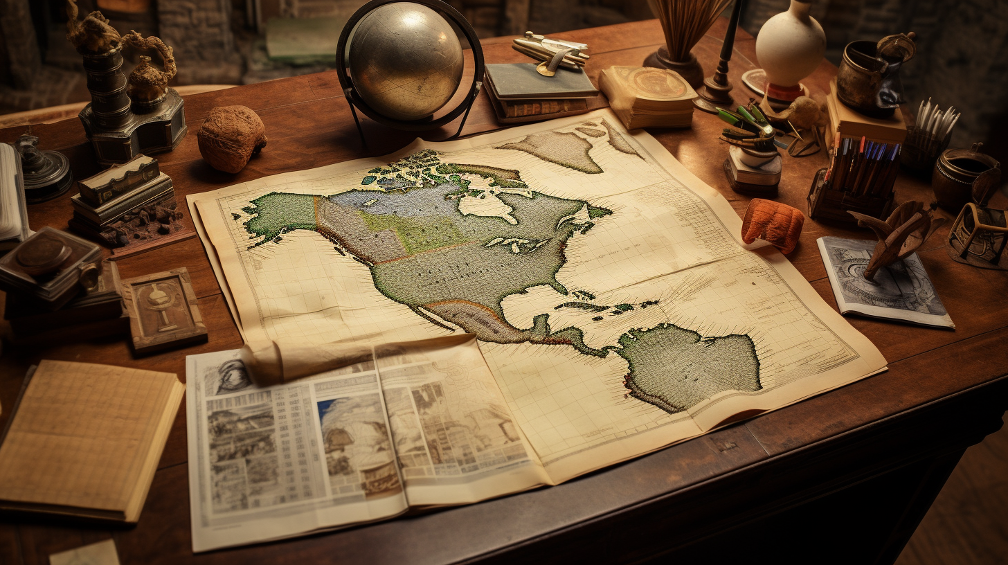
Los Fundadores: Finding Your Spanish Ancestors in México
The following presentation offers suggestions for tracing your Mexican ancestors back to Spain or Portugal. Although we offer research suggestions and show the reader resources to locate ancestors from the Iberian Peninsula, it is important to state the following:

Indigenous Puebla: Land of the Náhuatl Speakers
There is strong evidence that Puebla has been inhabited for a long time. In fact, the skull of the Texcal Man — which was found in a cave near Tehuacán in southeastern Puebla — has been dated at 7,480 years old. For the past millennium, several cultures — including the Olmec, Toltec, Náhuatl, Popoloca, Totonac, Mazatec and Otomí cultures — have thrived in the region that is now called Puebla. However, by the 15th Century, the Náhuatl-speakers of the Aztec Empire conquered nearly all of Puebla and ruled it until the coming of Hernán Cortés and the Spaniards. When the Spaniards destroyed the mighty Aztec Empire, the empire’s Puebla territories devolved into the hands of the Spanish Empire.

Indigenous San Luis Potosí: The Land of the Huastecos and Náhuatl
The land-locked state of San Luis Potosí (SLP) is located in center- north Mexico. With a surface area of 61,137 square kilometers (representing 3.1% of the total area of the Mexican Republic), San Luis Potosí touches nine other Mexican states.

The Surname Orozco: From Vizcaya to Aguascalientes
The surname Orozco (or Orosco) is a surname that has been prominent throughout both Spain and Mexico over the last few centuries. According to Richard D. Woods and Grace Alvarez-Altman, “Spanish Surnames in the Southwestern United States: A Dictionary,” two elements form this surname: “oros” which means holly tree and the suffix “-ko” which suggests place. Orozco therefore means place of the holly trees. Orozco is also believed to have been derived from the Latin word “orosius” – the son of bringer of wisdom.

Indigenous Nuevo León: A Region of Small, Mutually Antagonistic Tribes
Some historical sources have referred to four primary indigenous groups inhabiting Nuevo León at the Spanish contact in the late 1500s. They included the Alazapas in the north, the Guachichiles in the south, the Borrados in the east and Coahuiltecans in the west. In essence all of these groups had ties to either the Coahuiltecans or the Tamaulipec bands (who were, in essence, a sub- group of the Coahuiltecans). The Coahuiltecan tribes were made up of hundreds of small autonomous bands of hunter-gatherers who ranged over eastern Coahuila, northern Tamaulipas, most of Nuevo León and southern Texas.

The Indigenous People of Central Mexico: 1111 to 1521
Each part of the Mexican Republic has a unique and fascinating history, but a great deal attention has been given to the Indian groups that inhabited central México, in particular the present-day Distrito Federal (Federal District), known more commonly as Mexico City. Nearly 500 years ago, Hernán Cortés marched his small army of Spaniards and indigenous allies inland from Veracruz to confront the might of Emperor Moctezuma in Tenochtitlán. And, as a result, a patchwork of native kingdoms became the colonial fiefdom of a European monarch (the King of Spain).

The Indigenous People of Mexico City: 1895-2010
Each part of the Mexican Republic has a unique and fascinating history, but a great deal attention has been given to the Indian groups that inhabited central México, in particular the present-day Distrito Federal (Federal District), known more commonly as Mexico City. In fact, in 2016, the Federal District’s name was changed to the State of Mexico City. Nearly 500 years ago, Hernán Cortés marched his small army of Spaniards and indigenous allies inland from Veracruz to confront the might of Emperor Moctezuma in Tenochtitlán. And, as a result, a patchwork of native kingdoms became the colonial fiefdom of a European monarch (the King of Spain).
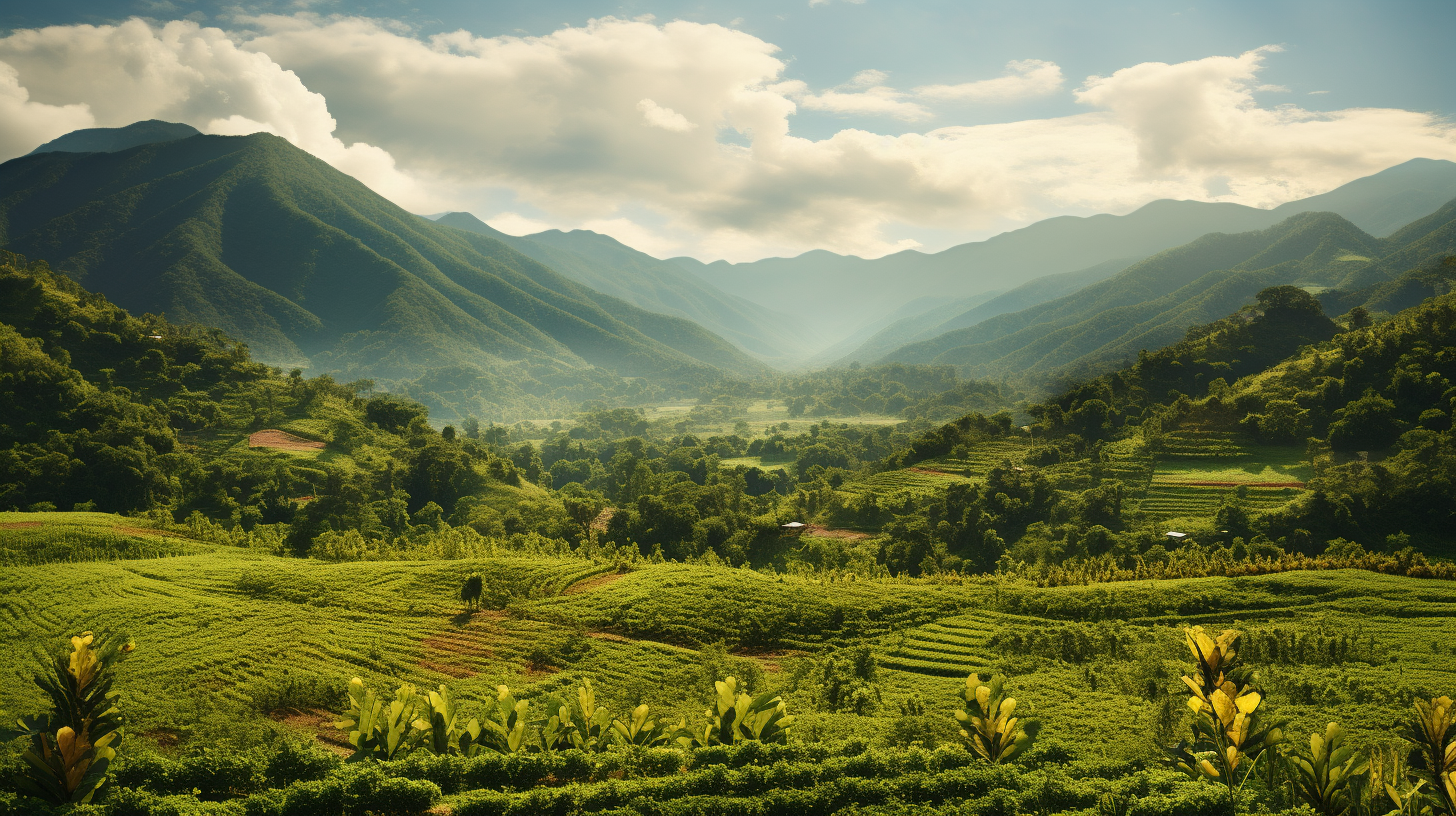
Chiapas: Forever Indigenous
In recent decades, the State of Chiapas – long a neglected and oppressed region of the Mexican Republic – has been thrust onto the world stage and into the media spotlight. The attention given to the political situation in Chiapas has initiated a great interest in the plight of the indigenous people of that state. But an understanding of the present-day situation in this southern state requires a review of its history and its complex ethnic diversity.

The Indigenous History of Jalisco, Zacatecas and Aguascalientes
Nueva Galicia’s Indigenous People: Established in 1548, the Spanish province of Nueva Galicia embraced 180,000 kilometers and included most of present-day Jalisco, Nayarit, Aguascalientes and Zacatecas.

Indigenous Nuevo León: Land of the Coahuiltecans
The State of Nuevo León is located in the northeast of México and touches the United States of America to the north along 14 kilometers of the Texas border. Nuevo Leon is surrounded by the states of Coahuila, Tamaulipas, San Luis Potosí, and Zacatecas. Nuevo Leon is made up of 64,156 square kilometers, which is equal to 3.3% of the national territory and makes the state the 13th largest state of Mexico. Politically, the state is divided into fifty-one municipios.

Mexican Politics: Part 3 (1846 to 1876)
For nearly a decade, Texas existed as an independent republic, but in 1845, the young republic joined the United States as the 28th state. When James K. Polk became the President of the U.S. in 1845, he had his eyes on California, New Mexico and the rest of what is today the U.S. Southwest. When his offer to purchase those lands was rejected by Mexico, he instigated a fight by moving troops into a disputed zone between the Rio Grande and Nueces River that both countries had previously recognized as part of the Mexican state of Coahuila.

Mexican Politics: Part 2 (1822 to 1855)
With independence, the former Spanish colonies of Nueva España, Nueva Galicia and Nueva Vizcaya became the “United Mexican States.” The name Mexico was taken from the capital city of Mexico City, formerly Tenochtitlán, named for the dominant Aztec tribe, the Mexica. Iturbide was named President of the Provisional Governing Junta, which set about the task of finding a member of a European royal family to take the throne of Mexico. He served as president from Sept. 1821 to May 1822. Eventually, thanks to his overwhelming support from the elites and his role in Mexico’s independence, Iturbide was appointed First Constitutional Emperor of Mexico on May 19, 1822.

Mexican Politics: Part 1 (The Struggle for Independence)
At the beginning of the Nineteenth Century, Mexico was a colony of Spain, a European nation located approximately 5,500 miles (8,850 kilometers) from its Gulf Coast shoreline. In 1810, the Spanish Empire consisted of 13.7 million square kilometers (5.3 million square miles) and occupied 9.2% of the world’s land area, most of which was in the Americas. Spain had the fifth largest empire in world history.

A Century of Turmoil: Mexico’s Social and Political Process
The Spanish Empire got off to a bad start at the beginning of the Nineteenth Century. In addition to her Caribbean, Central American, and Mexican possessions, Spain had gained possession of France’s extensive Louisiana territory in 1769. However, in 1800, Emperor Napoleon of France forced Spain to return Louisiana to France by the Treaty of San Ildefonso. Three years later, France sold Louisiana to the United States.

Indigenous Durango: Land of the Tepehuanes
The State of Durango is a landlocked state located in northwestern Mexico. As the fourth largest state of the Mexican Republic, Durango covers an area of 123,317 square kilometers and takes up 6.3% of the national territory. The state has common boundaries with Chihuahua and Coahuila de Zaragoza on the north, Zacatecas on the east and southeast, Nayarit on the southwest, and Sinaloa on the west. Politically, Durango is divided into 39 municipalities.

The First Families of Los Angeles
Has your family lived in Los Angeles for many generations? Do you have any of the following surnames: Verdugo, Sepulveda, Avila, Rosas, Higuera, Lugo, Domínguez, Serrano, Olivas, Ybarra, Palomares, Rodríguez, Reyes, Romero, Valenzuela, Pico or Feliz? Or did you or your family come from the states of Sinaloa or Sonora?
The Féliz Family: Pioneers of Los Angeles
The raw materials of Spain’s settlement of California were Mexican soldiers. These soldiers were men who left behind their parents and siblings in Sinaloa and Sonora to serve on the northern outskirts of Spain’s empire during the 1770s and 1780s. One family that contributed several soldiers to Spain’s colonial effort was the Féliz family of Álamos, Sonora.
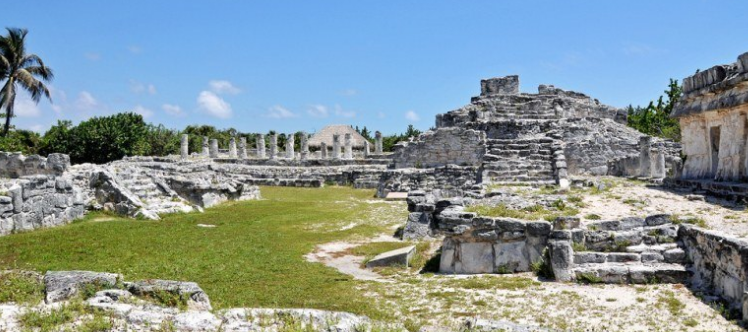
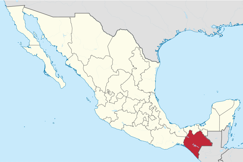
Indigenous Quintana Roo: The Last Two Centuries (Part 2)
The State of Quintana Roo lies on the eastern end of the Yucatán Peninsula in Southeastern Mexico. Quintana Roo also neighbors the Mexican States of Yucatán (on the northwest) and Campeche (on the southwest) and the nations of Belize and Guatemala (on the south). The state consists of only 44,825 square kilometers, which is equal to 2.0% of the national land mass. While the western and northern coasts of the Yucatán Peninsula are on the Gulf of Mexico coast, the eastern coast of the Yucatán — including Quintana Roo — touches the Caribbean Sea.

Indigenous Quintana Roo: From the Pre-Hispanic Period through the Colonial Period (Part 1)
The State of Quintana Roo lies on the eastern end of the Yucatán Peninsula in Southeastern Mexico. Quintana Roo also neighbors the Mexican States of Yucatán (on the northeast) and Campeche (on the southeast) and the nations of Belize and Guatemala (on the south). The state consists of only 44,825 square kilometers, which is equal to 2.0% of the national land mass. While the western and northern coasts of the Yucatán Peninsula are on the Gulf of Mexico coast, the eastern coast of the peninsula — including Quintana Roo — touches the Caribbean Sea.

Indigenous Sinaloa: From the Colonial Period to the Present (Part 2)
The State of Sinaloa, with a surface area of 58,200 square kilometers (22,471 square miles) is basically a narrow strip of land running along the Pacific Ocean and represents only 2.9% of the national territory, ranking it as the 17th largest state. Sinaloa is bordered to the north by Sonora and Chihuahua; to the south, by Nayarit; to the east by Durango, and to the west, by the Gulf of California.
Article Categories
- Aguascalientes 14
- Arizona 4
- Baja California 5
- Baja California Sur 2
- California 17
- Campeche 4
- Census 35
- Chiapas 3
- Chihuahua 13
- Coahuila 7
- Colima 1
- Conquistador Chronicles 2
- Durango 2
- Ethnic Identity 39
- Genealogy 35
- Guanajuato 8
- Guerrero 8
- Hidalgo 2
- Indigenous Insights 96
- Jalisco 25
- Mexico City 11
- Michoacan 7
- Morelos 4
- Nayarit 3
- New Mexico 4
- Nuevo Leon 7
- Oaxaca 6
- Politics 10
- Puebla 5
- Queretaro 1
- Quintana Roo 4
- San Luis Potosi 11
- Sinaloa 6
- Sonora 16
- Southwest US 26
- State of Mexico 5
- Tabasco 3
- Tamaulipas 11
- Texas 7
- Tlaxcala 7
- Veracruz 6
- Yucatan 6
- Zacatecas 13