Articles
Mexican States
Southwest United States
Heritage and Governance

Indigenous Guerrero and the Census
The Mexican Census Paints a Picture
From 1895 to 2015, the Mexican census has painted a picture of Mexico’s people, providing details about languages spoken (Spanish, foreign and indigenous), religion, education, literacy, employment and migration. From the beginning, the Mexican census provided details about indigenous languages spoken by its citizens. However, in the first half century, it is possible that there were undercounts of indigenous language speakers because some may have failed to declare their language status for fear of affecting their position within the community. In addition, poor communications channels with rural, isolated indigenous communities may also have caused an undercount of the indigenous people.

Indigenous Nayarit and the Census
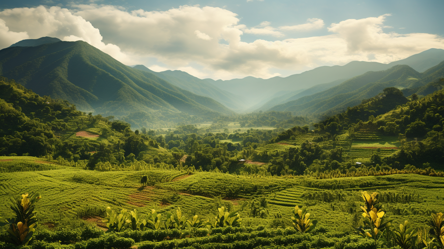
The State of Nayarit, located in northwestern Mexico, has an area of 27,857 square kilometers, thus taking up 1.4% of the national territory of Mexico and is the 23rd largest state. Nayarit’s 1,181,050 inhabitants occupy Nayarit’s twenty municipios but only ranks 29th among the 31 states and the Distrito Federal in terms of population. The capital of Nayarit is Tepic.

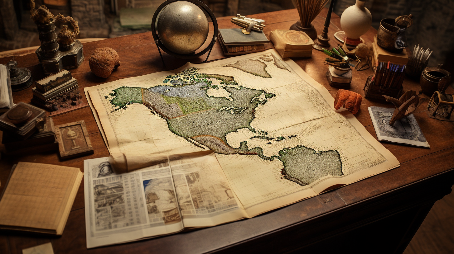
Searching for Your Indigenous Roots in Mexico
If a person is trying to determine the name of the Indian tribe from which they descend, they may find out that the answer is very complex and involves many potential tribes. Each and every one of us has four grandparents and eight great- grandparents. Fourteen generations ago – around 1540 – you had 16,384 12th great- grandparents, many of whom may have been indigenous, some of whom travelled from other areas of Mexico to the towns where your ancestors lived.

Indigenous Baja California and the Census
The State of Baja California occupies a total area of 71,450 square kilometers (27,587 square miles), which makes up 3.6% of the national territory. Baja California is the 12th largest state in the Mexican Republic. Politically, this area is divided into a total of five municipios: Ensenada, Mexicali, Tecate, Tijuana and Playas de Rosarito.

Mexico’s Indigenous Identity in the 2015 Intercensal Survey
In 2016, the Mexican government agency, Instituto Nacional de Estadística Geografía e Informática (INEGI), published the 2015 Intercensal Survey, which upgraded Mexico’s socio-demographic information to the midpoint between the 2010 census and the census to be carried out in 2020. With a sample size of over 6 million homes, this survey provides information on the national, state and municipio level, as of March 15th, 2015.

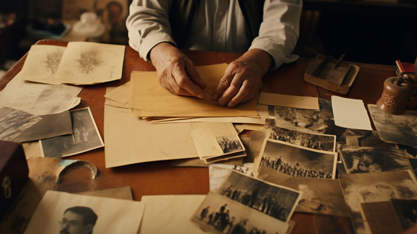
Tools for Finding Ancestors in Mexico
This presentation explores what tools are out there for you to begin your research and quickly advance. In addition to tools, databases and resources, tips on how to decipher records and overcoming brick walls is explored.
This presentation was conducted by Sindy Valdez, for the Society of Hispanic Historical and Ancestral Research.
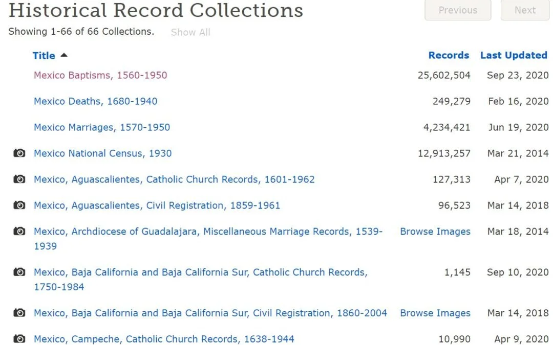
Navigating FamilySearch.org for Mexican Records
The most important FamilySearch.org link is the following one, which leads you to 66 Mexican collections, primarily Catholic Church records (going back, in some cases, to the 1500s and 1600s) and Civil Registry records (for municipio records).
Explorations in Mexican Genealogy
Each of us has two parents, four grandparents, eight great-grandparents and 16 great-great-grandparents. Fourteen generations ago – around 1540 – you had 16,384 12th great-grandparents. Within this generation you may have a wide range of ethnicities, including Spanish, French, Portuguese and Basques, as well as indigenous tribes from disparate parts of Mexico.

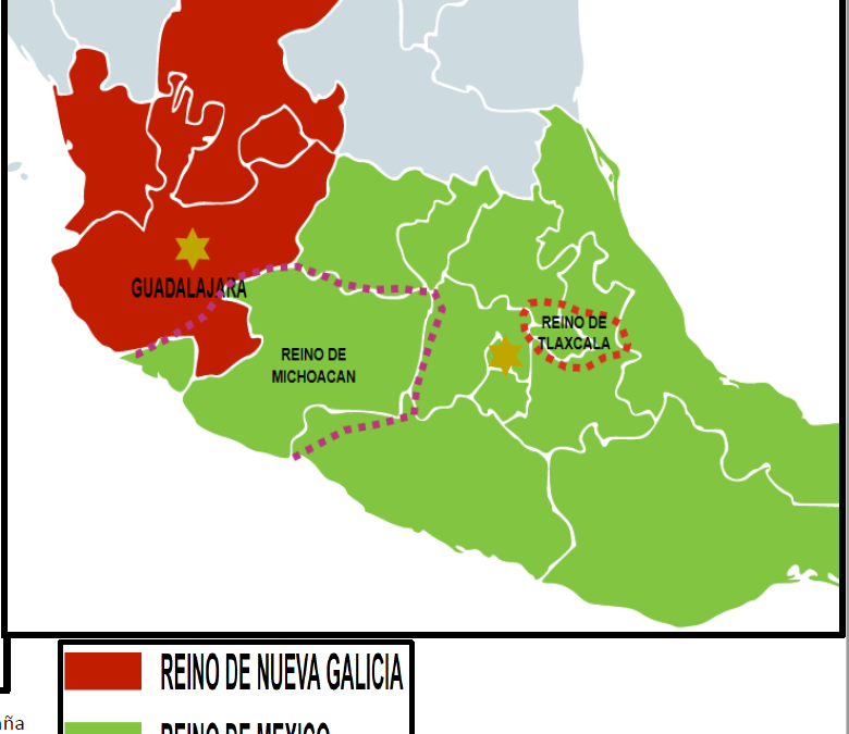
Indigenous Jalisco: From the Spanish Contact to 2010
The modern state of Jalisco consists of 78,597 square kilometers located in the west central portion of the Mexican Republic and taking up 4.0% of the national territory. As the seventh largest state in Mexico, Jalisco is politically divided into 124 municipios. With a 2010 population of about 7,844,830 inhabitants, Jalisco has the fourth largest population in Mexico with 6.6% of the national population.

Aguascalientes: Independence Sealed with a Kiss
The Mexican state of Aguascalientes (“Hot Waters”) is located in central Mexico. Surrounded by Zacatecas (on the north and west) and by Jalisco (on the south and east), Aguascalientes occupies 5,589 square kilometers, corresponding to only 0.3% of the Mexico’s surface area. Although it is one of the smallest Mexican states, Aguascalientes holds a position of great importance in the Mexican Republic, in large part because of its strategic location within the country. With its textile, electronics and auto parts industries, Aguascalientes represents an integral part of the Mexican economy.

Indigenous Aguascalientes: The Sixteenth Century Land of War
The State of Aguascalientes, located in central Mexico, is one of the smallest states in the Mexican Republic. Sharing its borders with Jalisco (on the south) and Zacatecas (on the north, west and east), Aguascalientes occupies a total of 5,616 square kilometers (2,168 square miles), which represents only 0.3% of Mexico’s national territory and is the twenty-eighth largest state in terms of area. Politically, Aguascalientes is divided into eleven municipios.

The Náhuatl Language of Mexico: From Aztlán to the Present Day
Across the 761,606 square miles (1,972,550 square kilometers) that comprise Mexico you can find a great variety of landscapes and climates. While mountains and plateaus cover more than two-thirds of her landmass, the rest of Mexico’s environment is made up of deserts, tropical forests, and fertile valleys. Mexico’s many mountain ranges tend to split the country into countless smaller valleys, each forming a world of its own. Over the last few thousand years, this has been a factor in the differentiation of a wide range of indigenous Mexican languages.

The Mexican Revolution and its aftermath 1910-1929
Porfirio Díaz (1830-1913) ̶a native of Oaxaca came to power in 1876 and essentially ruled the country until 1911. He was responsible for economic growth, industrialization and enhanced foreign investment, but had little regard for human rights. Diaz’s rule was both harsh and arbitrary. Much of Mexico’s economic system during his rule revolved around the hacienda system.

Who Were the Chichimecas?
If your ancestors are from Zacatecas, Guanajuato, Aguascalientes, Jalisco or San Luis Potosí, it is likely that you are descended from the indigenous peoples who inhabited these areas before the Spaniards arrived from the south. The historian Eric Van Young of the University of California at San Diego has called this area, the “the Center-West Region” of Mexico. This cultural region, according to Dr. Van Young, amounts to about one-tenth of Mexico’s present-day national territory.
The Indigenous History of Jalisco, Zacatecas, Guanajuato and Michoacán
Mexico’s Northern Mountainous Regions
The Sierra Madre Occidental Mountains run from Chihuahua into Durango, Zacatecas, Jalisco and farther south. The Sierra Madre Oriental Mountains run parallel to the Sierra Madre Occidental range on the eastern side of the country.
The Rubalcaba Surname in Aguascalientes
Origins in Santander
The surname Rubalcaba (also spelled Robalcava or Ruvalcaba) is known to have originated in the Mountains of Santander, with branches of the surname radiating from Medina de Cudeyo, Liérganes and Navajeda, three locations that are presently located in eastern Cantabria (northern Spain). Today, Cantabria is considered an autonomous area with Santander as its capital. It is bordered on the east by the Basque Autonomous Community, on the south by Castile and León (the provinces of León, Palencia and Burgos), on the west by Asturias and on the north by the Cantabrian Sea.

Cesar Chavez: Roots Deep in the Heart of Chihuahua
Cesar Chavez was an American hero, a person who was admired by both his supporters and his adversaries. In grammar school, many students learn about his advocacy and dedication to his causes, but few people know much about his roots. Nearly everyone knows that Cesar Estrada Chavez was born on March 31, 1927 near Yuma, Arizona. The Arizona State Board of Health Certificate of Birth Number 594 states that Cesario Chavez was the legitimate son of Librado Chavez (38 years old, a farmer born in Mexico) and Juana Estrada (35 years old, a housewife also born in Mexico). His birthplace was listed as “North Gila Valley” in Yuma County. A copy of that birth record has been reproduced below [Arizona Department of Health Services, “Arizona Genealogy Birth and Death Certificates: Index.” Online: http://genealogy.az.gov/].

Dual Identity: The Indigenous Peoples Who Occupy the U.S.-Mexico Borderlands
This presentation discusses the native groups that occupied the regions adjacent to and on both sides of the U.S.-Mexico border over the last three centuries. While some of these tribes are well-known to us today (i.e., the Yaquis, Tohono O'odham, Kumeyaay, Cocopah, etc.), tribal groups that have disappeared as distinguishable cultural entities (i.e., Carrizos, Mansos, Jocome, Coahuiltecans, etc.) will also be discussed. In addition to the history of those tribes, we will explore the current status of the tribal communities that still exist today.

Mexico: Confrontation Between Church and State
The Cristero Rebellion affected the lives of many Mexicans. Many Mexican-American families still talk of it today. This work discusses the ideologies of the two combatants: The Mexican Government and the Catholic Church. The battles are not discussed here, but the beginning and end of the conflict are discussed as viewed by the American press.

Indigenous Northeastern Mexico: The Ancestors of the Tejanos
Among all the indigenous people of Mexico, understanding the Indians of Northeastern Mexico is very challenging, as nearly all of these tribal groups have disappeared as “distinguishable cultural entities.” The largest ethnic group ̶ the Coahuiltecans ̶ ranged through much of the northeast, including parts of Coahuila, Nuevo León, Tamaulipas and southern Texas. Today they do not exist.
Article Categories
- Aguascalientes 14
- Arizona 4
- Baja California 5
- Baja California Sur 2
- California 17
- Campeche 4
- Census 35
- Chiapas 3
- Chihuahua 13
- Coahuila 7
- Colima 1
- Conquistador Chronicles 2
- Durango 2
- Ethnic Identity 39
- Genealogy 35
- Guanajuato 8
- Guerrero 8
- Hidalgo 2
- Indigenous Insights 96
- Jalisco 25
- Mexico City 11
- Michoacan 7
- Morelos 4
- Nayarit 3
- New Mexico 4
- Nuevo Leon 7
- Oaxaca 6
- Politics 10
- Puebla 5
- Queretaro 1
- Quintana Roo 4
- San Luis Potosi 11
- Sinaloa 6
- Sonora 16
- Southwest US 26
- State of Mexico 5
- Tabasco 3
- Tamaulipas 11
- Texas 7
- Tlaxcala 7
- Veracruz 6
- Yucatan 6
- Zacatecas 13